Pratt Center Research
 Democratizing Planning
Transportation Equity Atlas
Maps | September 21, 2010
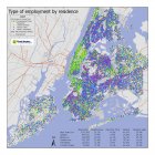
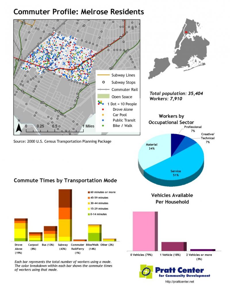
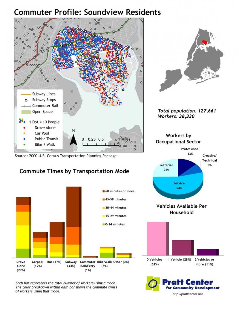
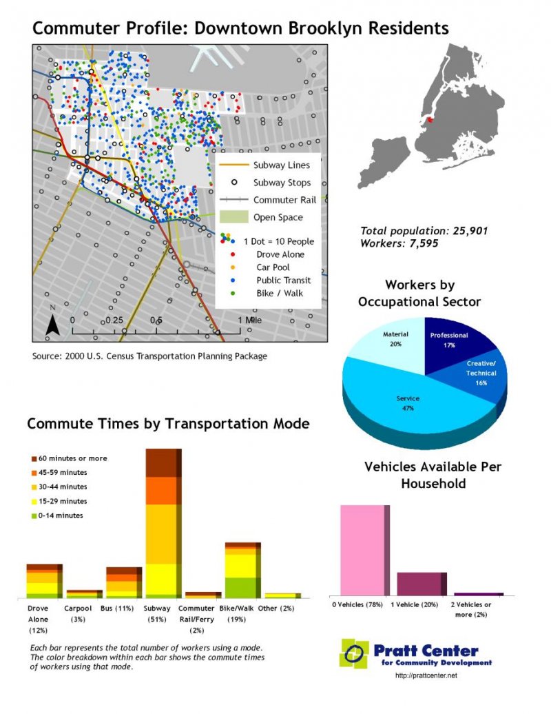
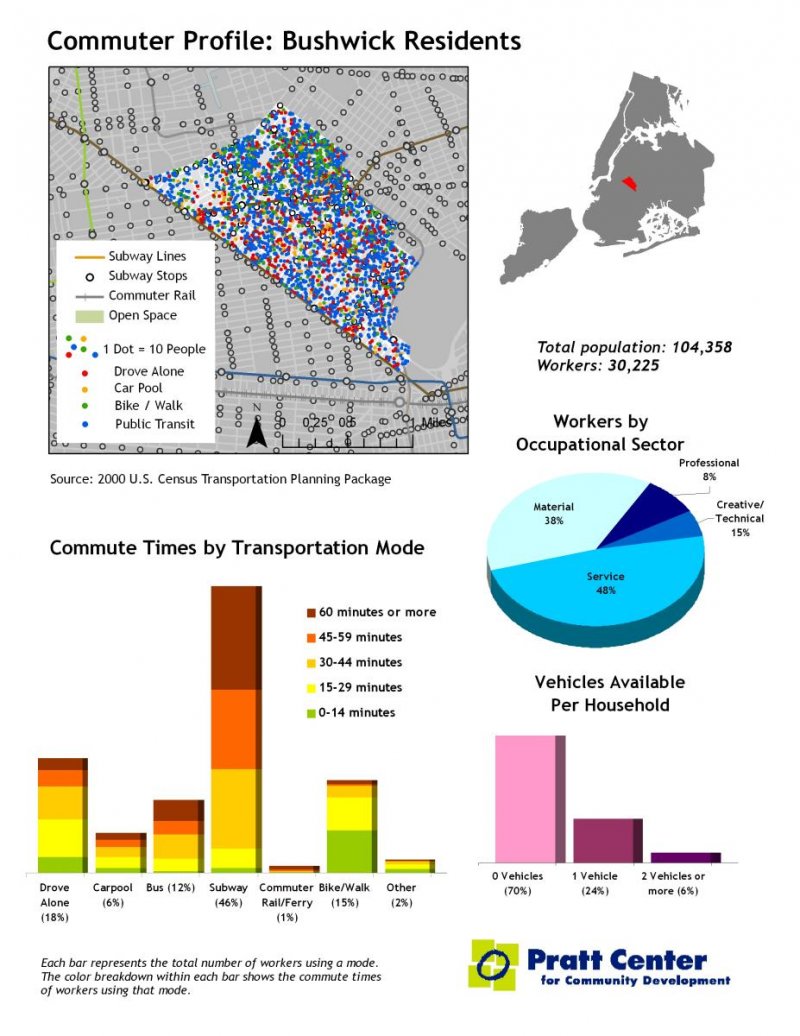
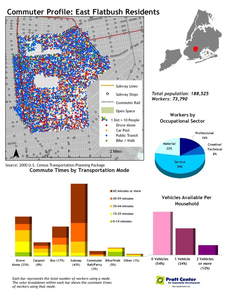
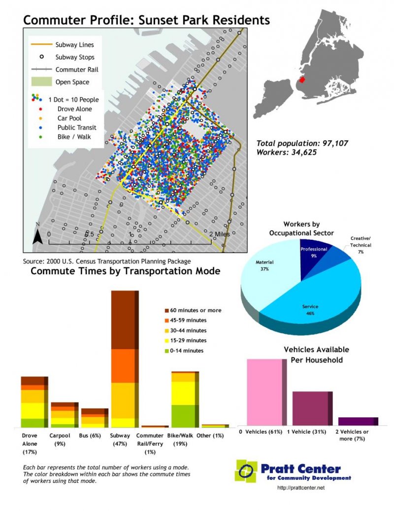
Pratt Center compiled the Transportation Equity Atlas to compare mobility and transit access among New York City neighborhoods. We found great disparities in transportation access between higher-income, professional workers and low-wage manual and service workers. High housing costs mean that most low-wage workers live in areas outside the city's subway-rich core. Those workers also must travel to work sites dispersed widely around the city and region. This leaves the lowest-paid workers with the longest commutes to work, and limits the geographic range of job opportunities for residents of high-unemployment communities.
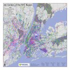
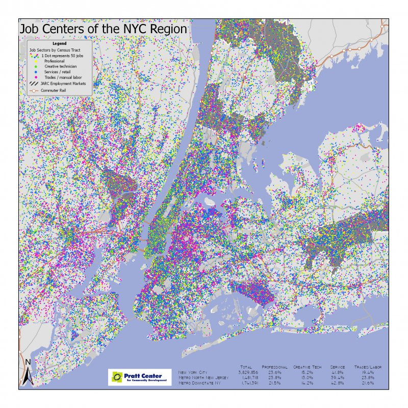
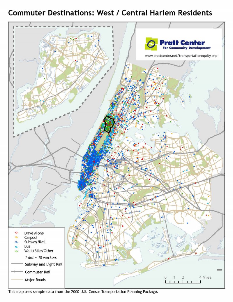
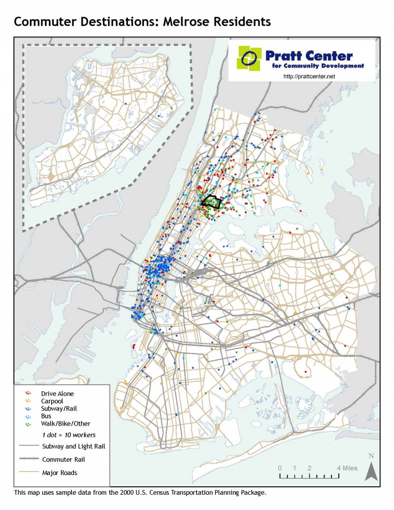
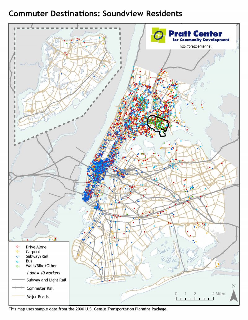
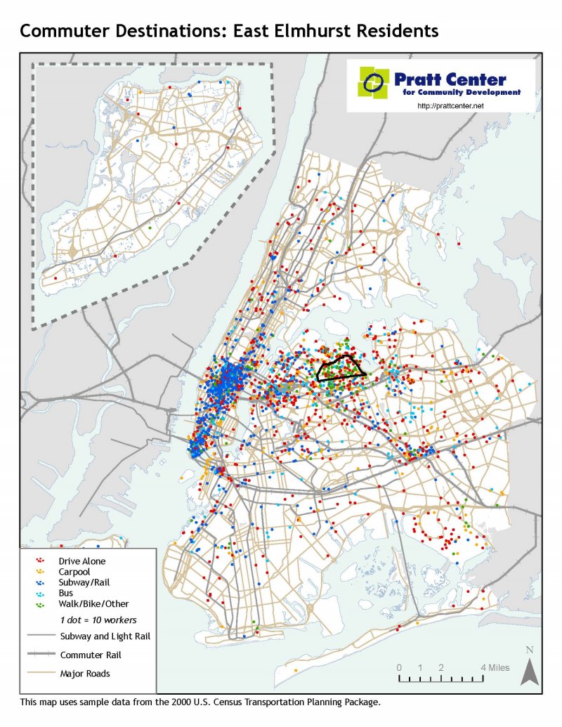
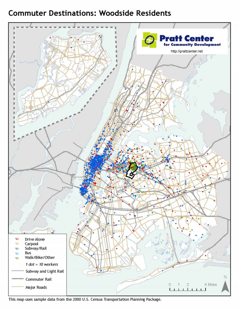
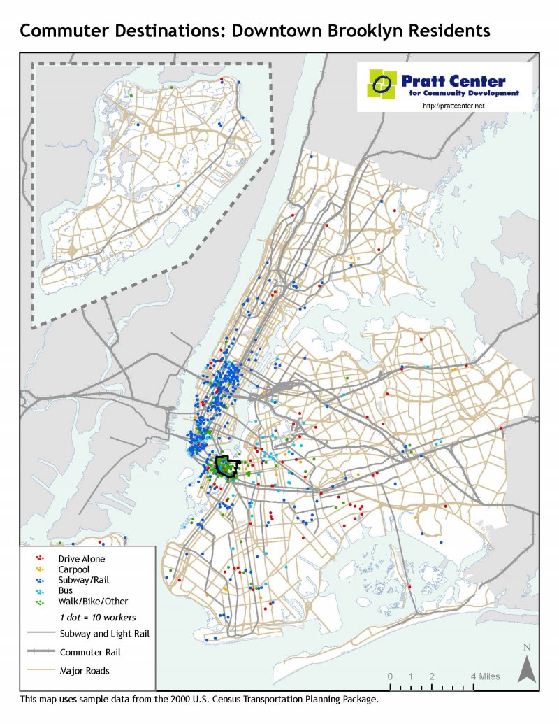
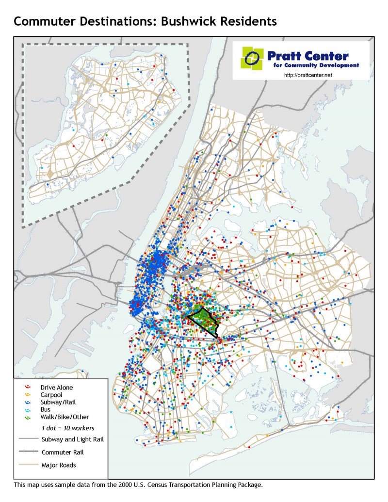
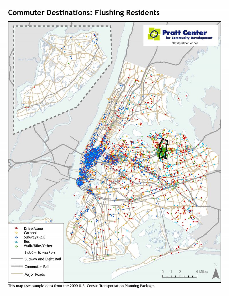
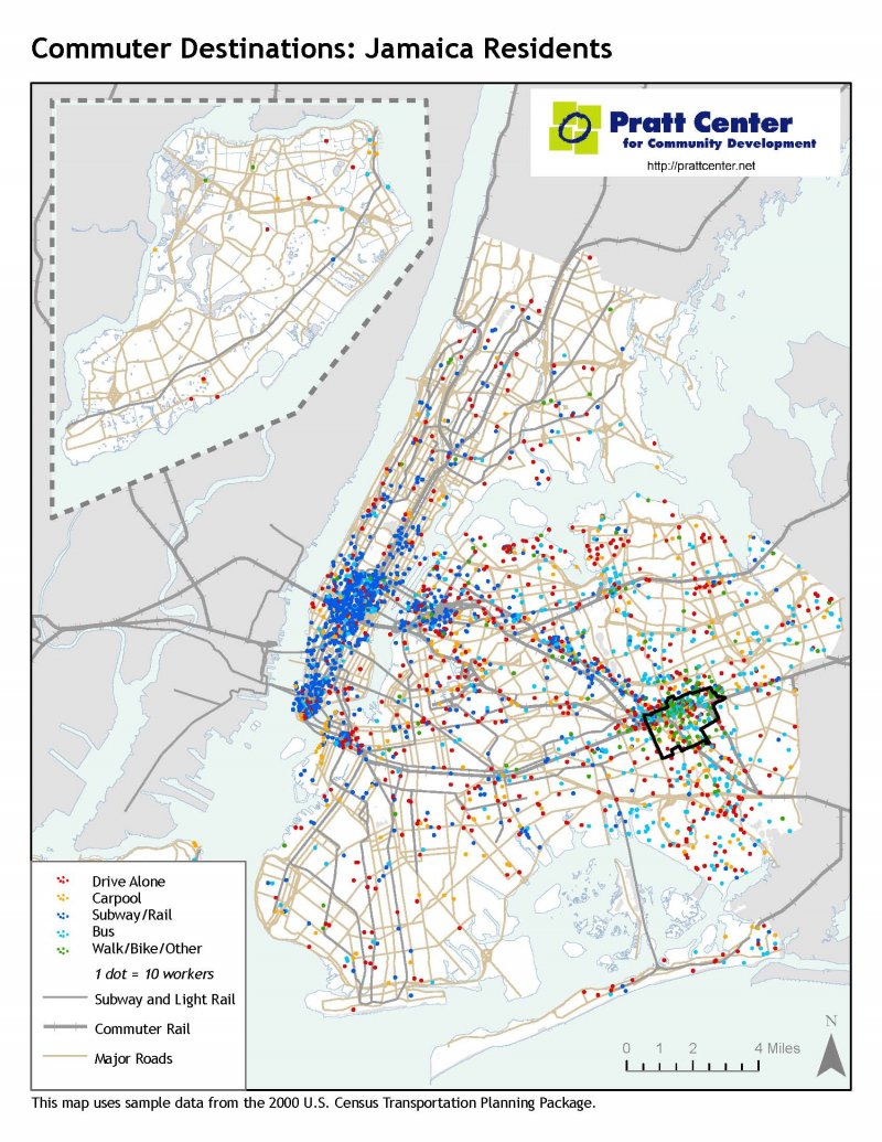
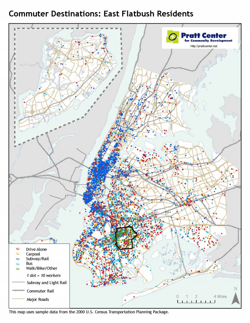
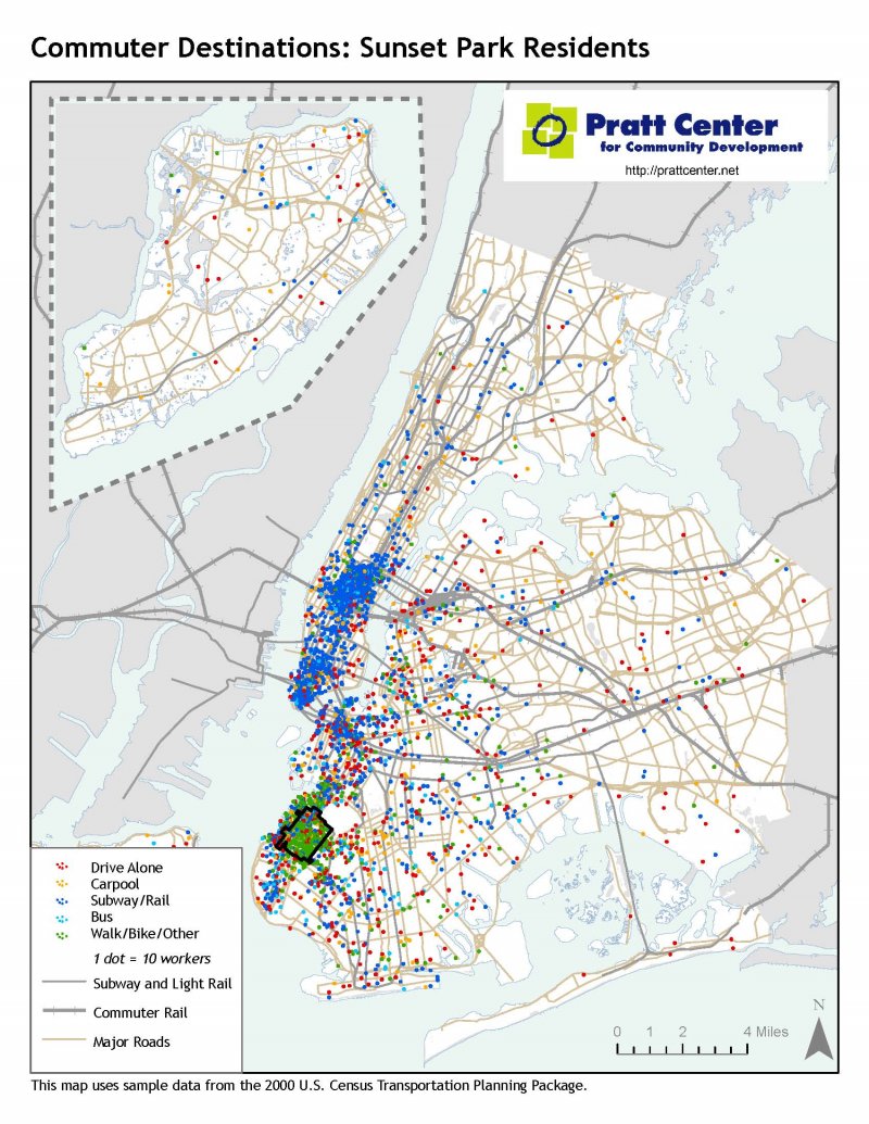
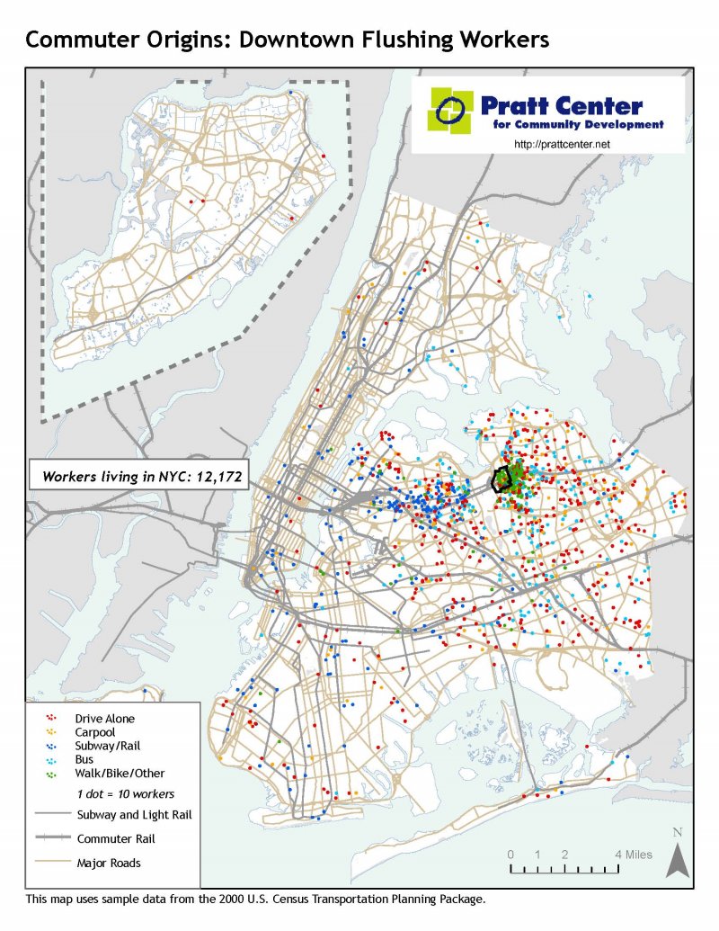
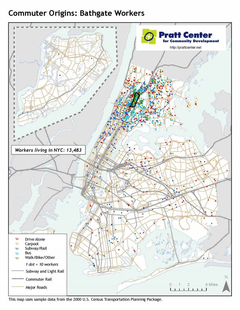
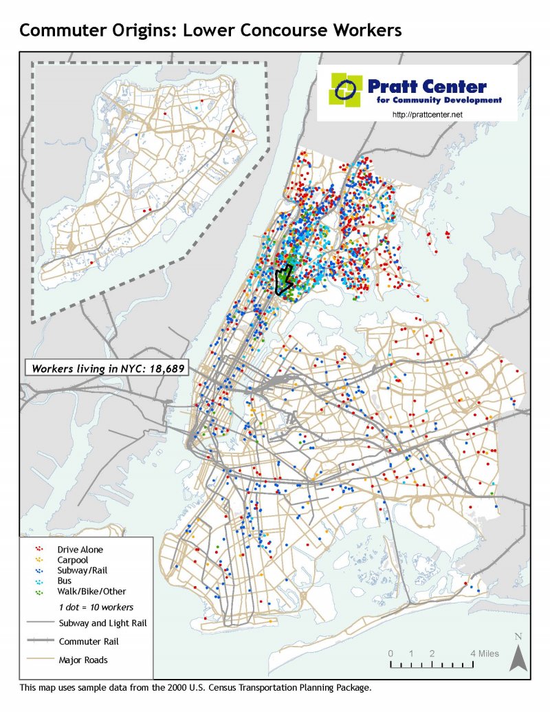
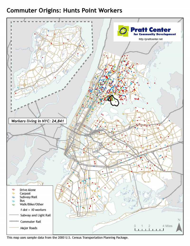
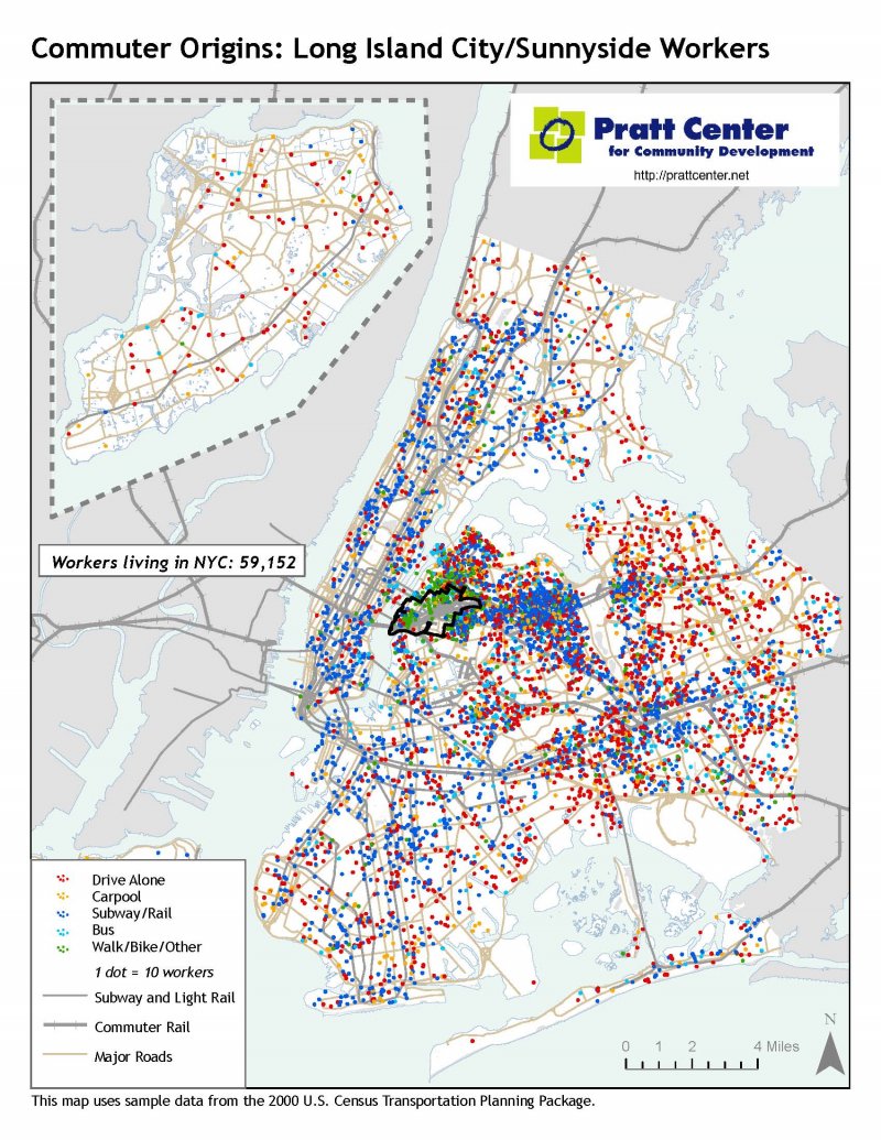
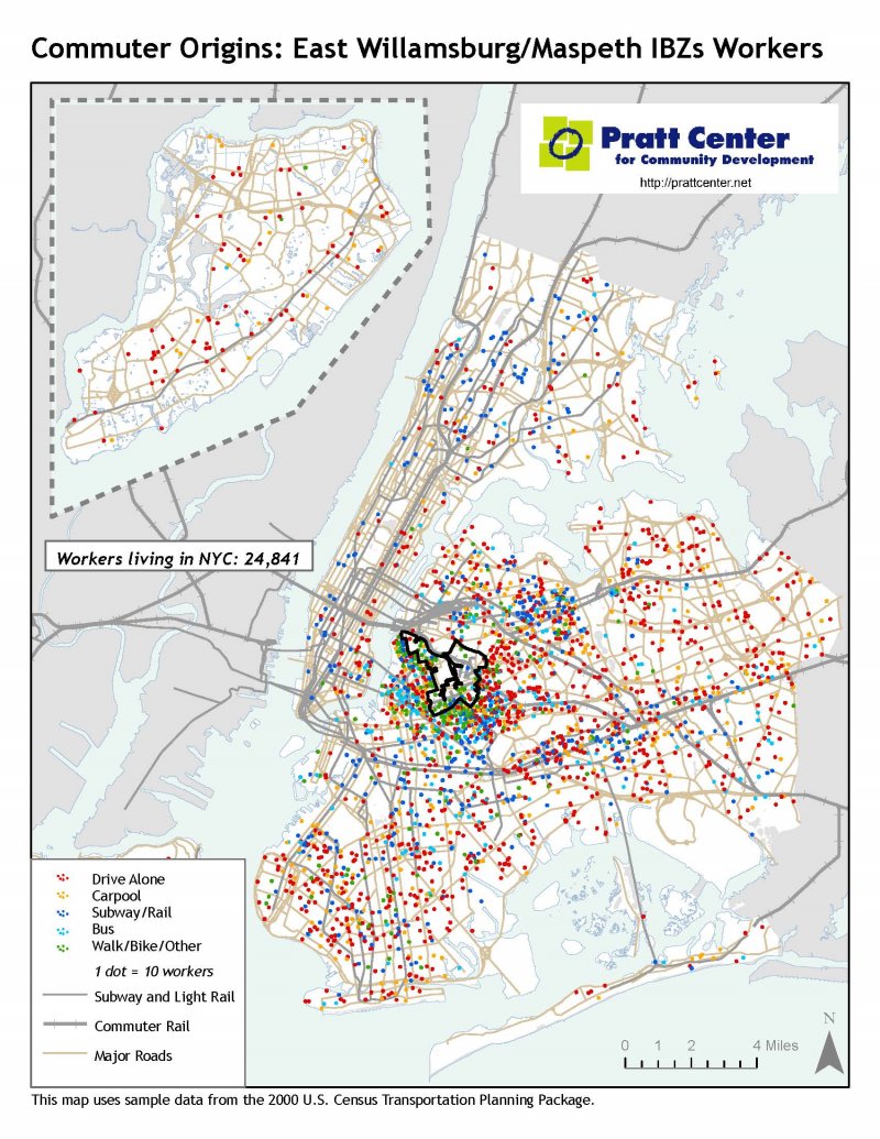
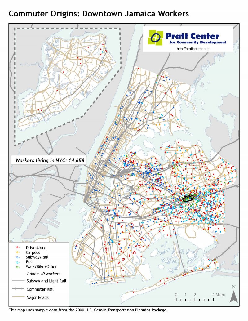
The maps show the commuting patterns of some 289,000 residents of 13 predominantly low- and moderate-income communities in Manhattan, Queens, Brooklyn and the Bronx, and similarly the patterns of workers arriving at major job centers in the Bronx, Brooklyn and Queens that together employ nearly 300,000 workers.
These maps show that a significant share of New York's workers travel long distances to get to work, and every day must reach destinations that are far outside the Manhattan central business district - south of 59th Street - where our radially-designed subway lines converge. The city's future economic growth will depend in part on how efficiently workers can get to these and other locations outside central Manhattan.
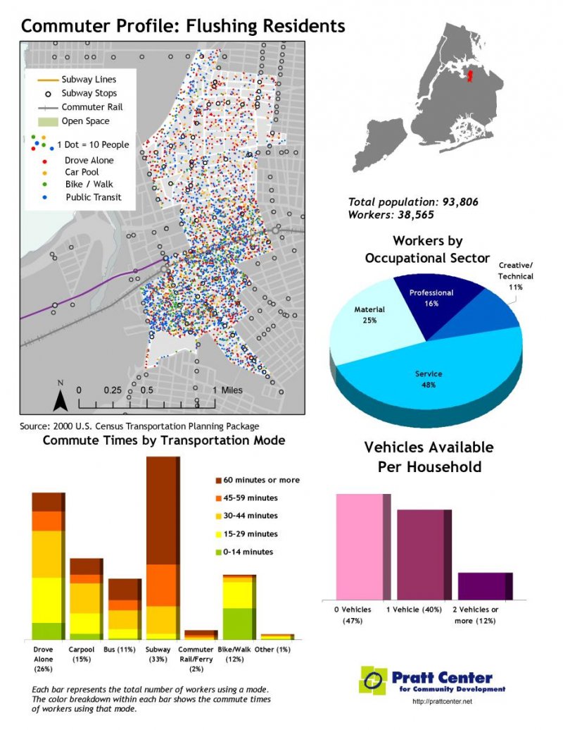
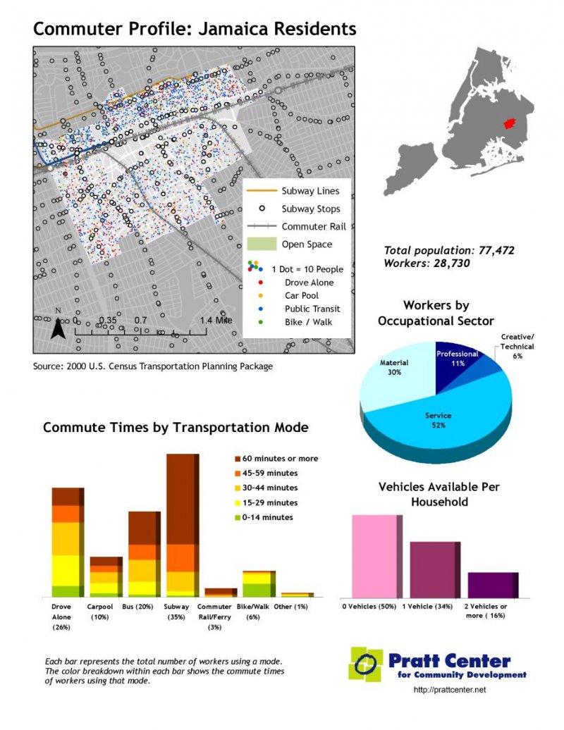
New York's boroughs outside Manhattan have the longest commute times in the country - the Queens average is 41 minutes - and they are getting longer. Lower-income New Yorkers have the longest rides to work: Three-quarters of a million New Yorkers travel more than one hour each way to work, and two-thirds of them earn less than $35,000 a year. By contrast, just 6 percent of these extreme commuters earn more than $75,000 a year. Black New Yorkers have the longest commute times, 25 percent longer than white commuters; Hispanic commuters have rides 12 percent longer.
To bridge the transportation gap, the City of New York and Metropolitan Transportation Authority need bold new approaches expanding transit infrastructure, to reach more homes and destinations, and to do this cost-effectively in a tough budgetary environment. The Transportation Equity Atlas shows the untapped potential of innovations like bus rapid transit to open transit access to employment and residential centers that until now have been underserved.
Maps Index
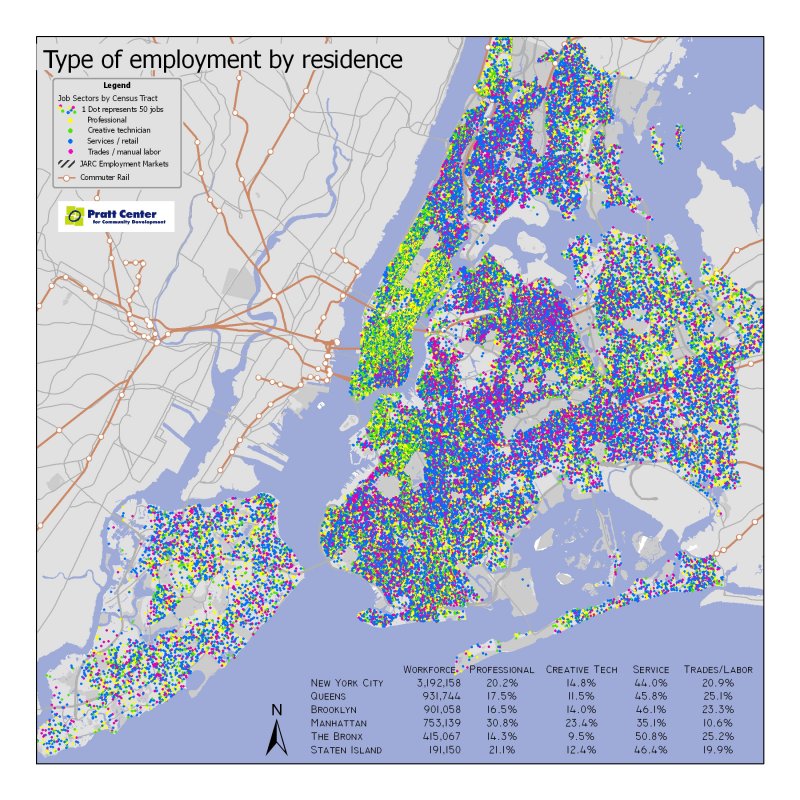
- Type of Employment by Residence
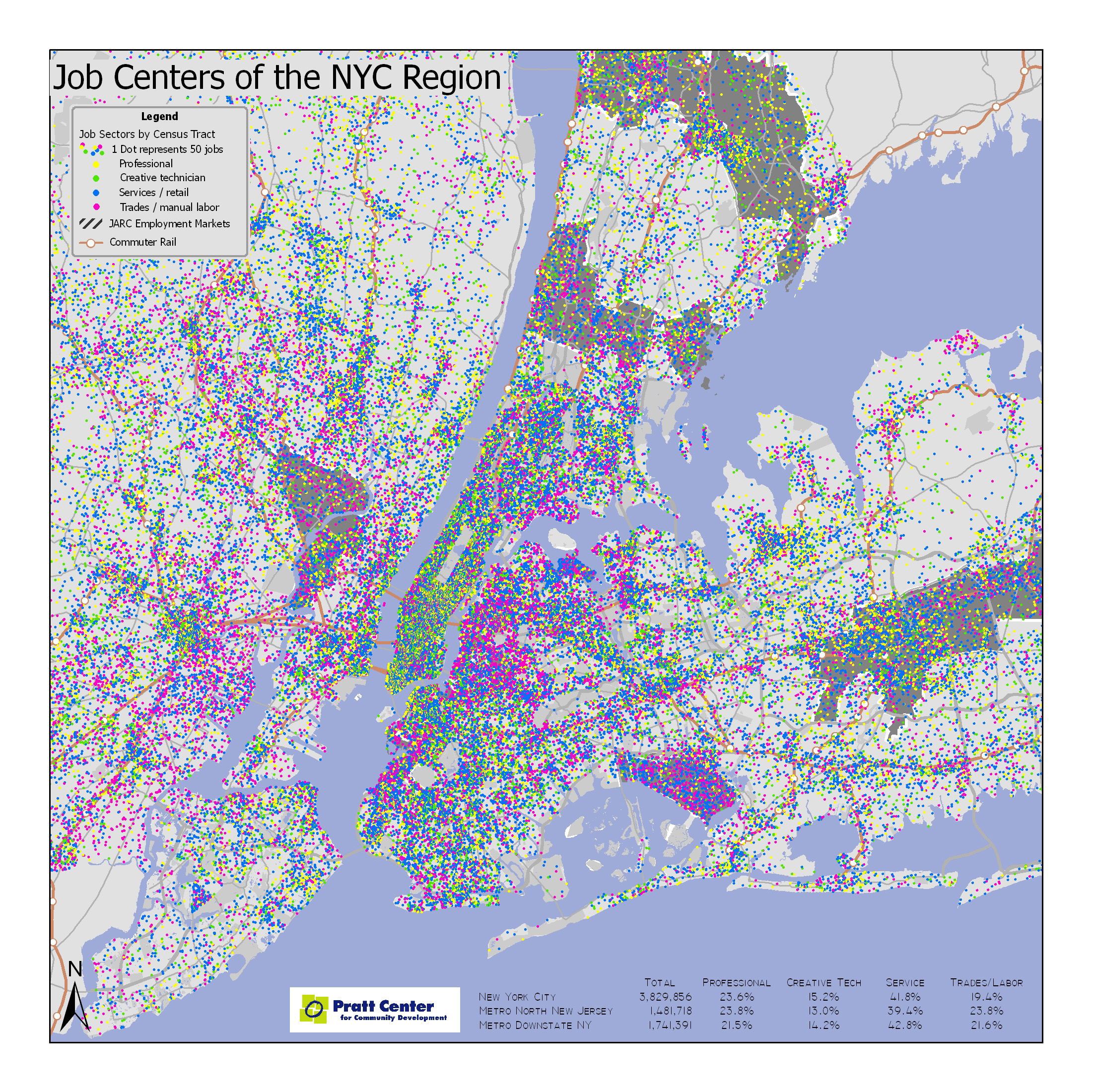
- Job Centers of the NYC Region
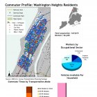
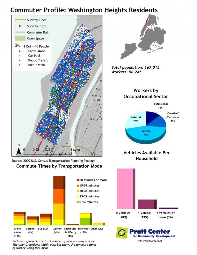
- Commuter Profile: Washington Heights
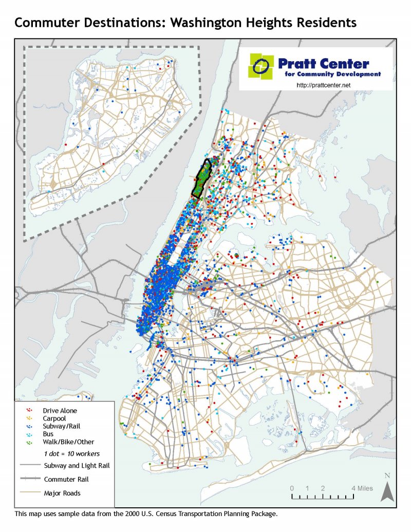
- Commuter Destinations: Washington Heights Residents
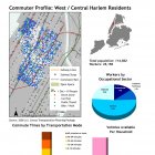
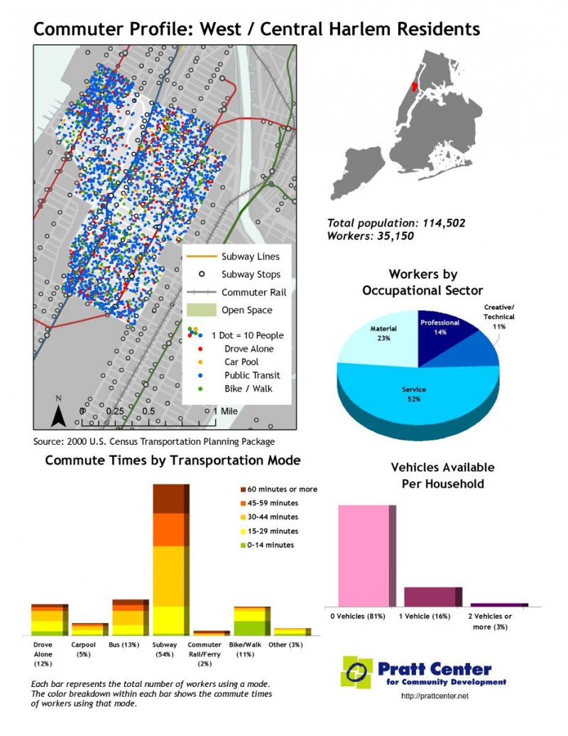
- Commuter Profile: West/Central Harlem
- Commuter Destinations: West/Central Harlem
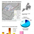
- Commuter Profile: Melrose
- Commuter Destinations: Melrose
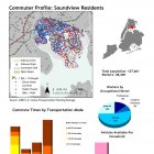
- Commuter Profile: Soundview
- Commuter Destinations: Soundview
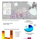
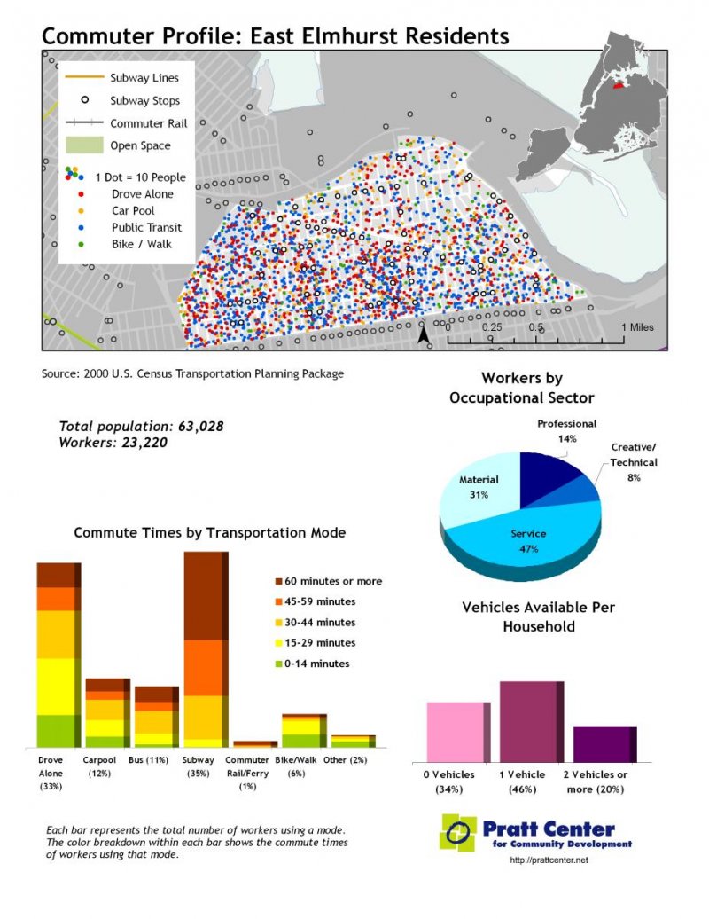
- Commuter Profile: East Elmhurst
- Commuter Destinations: East Elmhurst
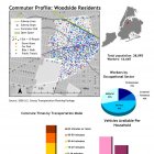
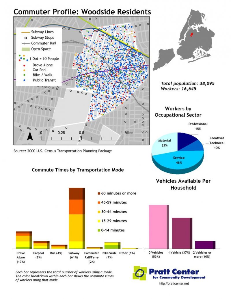
- Commuter Profile: Woodside
- Commuter Destinations: Woodside
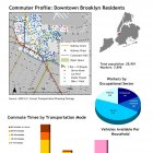
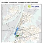
- Commuter Profile: Downtown Brooklyn
- Commuter Destinations: Downtown Brooklyn
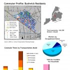
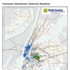
- Commuter Profile: Bushwick
- Commuter Destinations: Bushwick
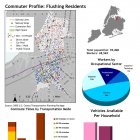
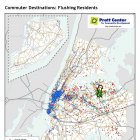
- Commuter Profile: Flushing
- Commuter Destinations: Flushing
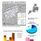
- Commuter Profile: Jamaica
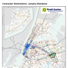
- Commuter Destinations: Jamaica
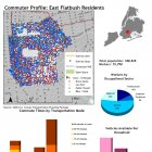
- Commuter Profile: East Flatbush
- Commuter Destinations: East Flatbush
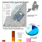
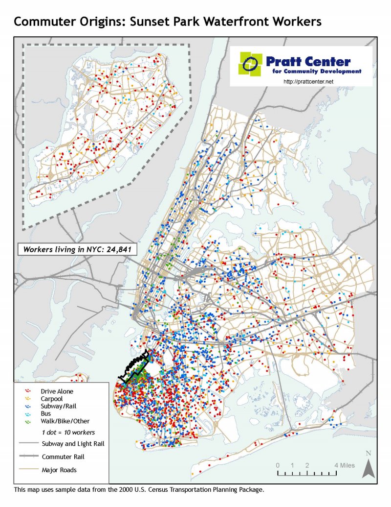
- Commuter Profile: Sunset Park
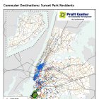
- Commuter Destinations: Sunset Park
- Commuter Origins: Flushing
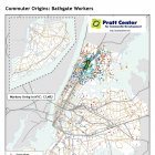
- Commuter Origins: Bathgate
- Commuter Origins: Lower Concourse
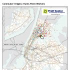
- Commuter Origins: Hunts Point
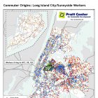
- Commuter Origins: Long Island City
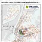
- Commuter Origins: East Williamsburg
- Commuter Origins: Downtown Jamaica
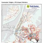
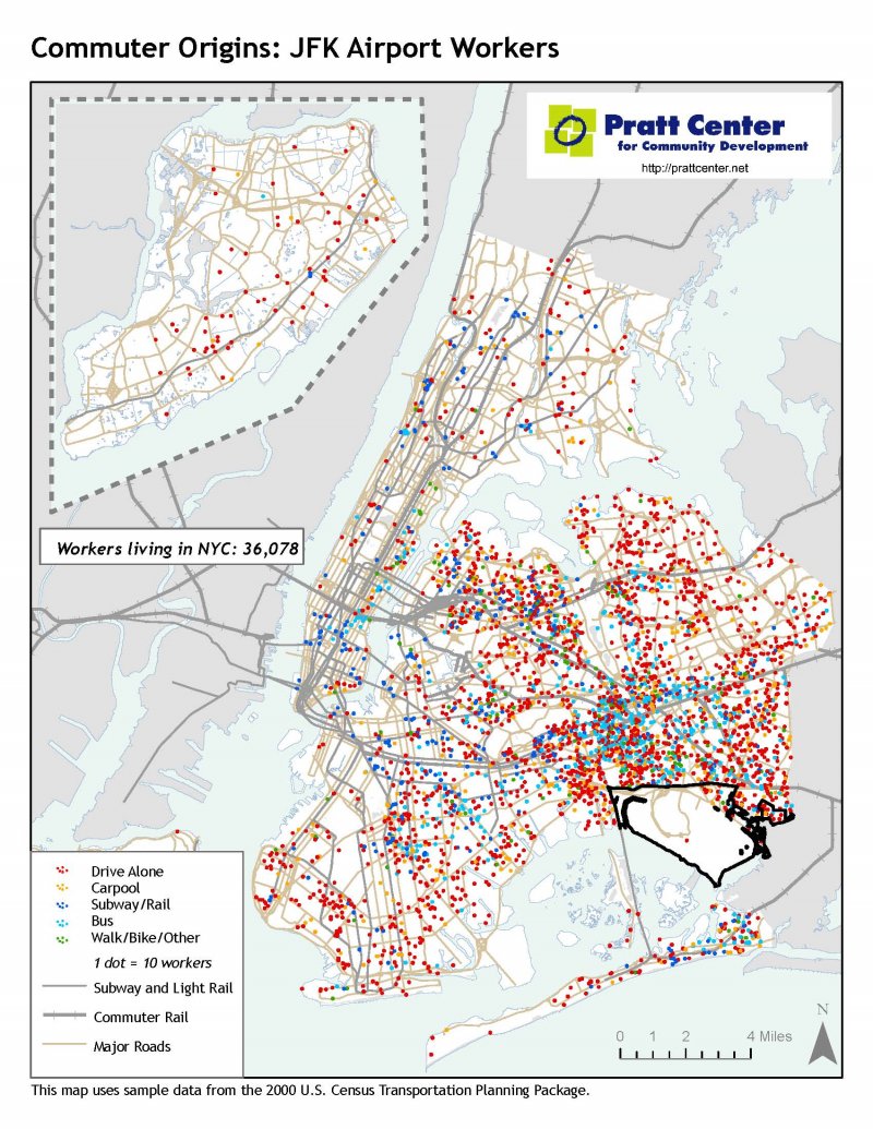
- Commuter Origins: JFK Airport
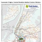
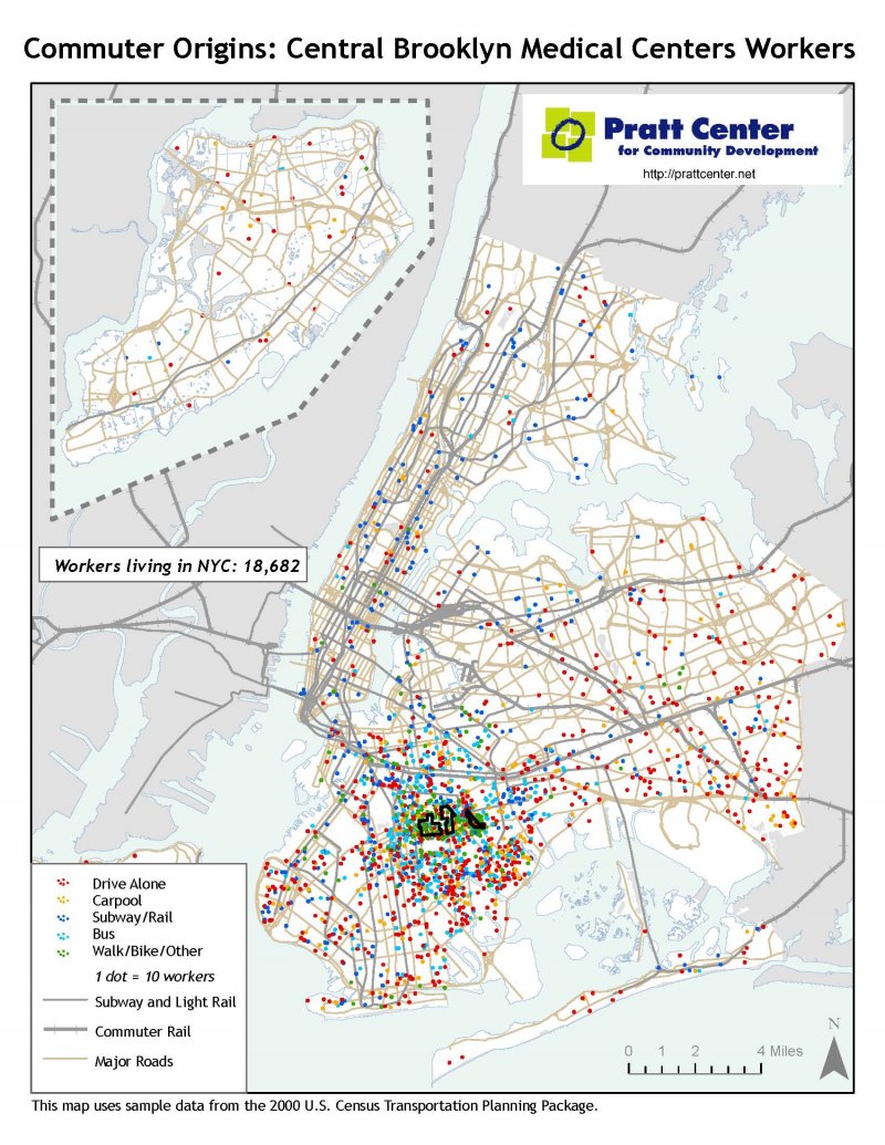
- Commuter Origins: Central Brooklyn Medical Centers
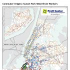
- Commuter Origins: Sunset Park